Sunday, September 18, 2011

Eklutna High Ridge Traverse

September 18th, 2011
24 miles, 7 true summits, 10,000 vertical feet

I had been saving this ridge hike for a fall day when the higher mountains had already recevied their termination dust.  September 18th arose with clear skies and calm winds.  Perfect!  As the day wore on, I experienced some varied weather - snow flurries and wind - but nothing to prevent me from finishing this great ridge. 

I started out from the Eklutna trailhead around 8:20 am and finished at 8:40 pm, so just over 12 hours to finish the roundtrip.  The ridge-traverse involves 7 true summits (prominence of at least 500 ft) and a number of lesser peaks.  The true peaks are:

Bright Peak (5875 ft)
Bleak Peak (5430 ft)
Yudikench Peak (5732 ft)
Peak 5450 (5450 ft)
Peak 5285 (5285 ft)
Salt Peak (5455 ft)
Pepper Peak (5450 ft)

I started in the Eklutna lake-side trail and then headed up the Eklutna overlook trail.  From there it was back-country travel until I descended from Pepper peak back to the Eklutna trailhaed.  Some easy scrambling and scree was involved, but most of the ridge traverse is over gradual terrain and on sheep trails. 

Especially Bright peak was a pleasant surprise.  I decided to climb the southwest ridge.  This was a fun ridge with great views overlooking the tundra below.  The ridge ended with a gully and exit crack leading to the summit ridge.  I didn't know if the exit crack was passable until I was about 50 yards away.  It turned out to be a fun little scramble.

Route outline of the Eklutna High Ridge Traverse.

Bright peak with southwest ridge in the center.

Bright peak southwest ridge and gully.

Bright peak exit crack.

Hunter Creek drainage.

Massive rams on Bright peak.

Bold peak seen from Pepper peak late in the afternoon.

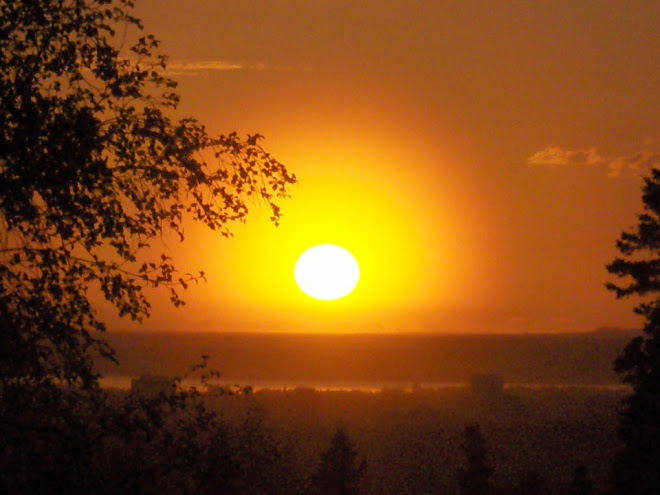
Finishing in the dark.

Western panorama from Yudikench peak with the Eklutna ridge traverse continuing to the left, the Pioneer ridge to the right, and Goat Creek in the center.

Eastern panorama from Peak 5285 showing the ridge leading back towards Yudikench peak (left).  Bright peak is in the in center and Bold peak on the right.

Eastern panorama from Pepper Peak showing the entire ridge system leading back towards Bold peak in the distance.  Eklutna lake shows to the right.

Sunday, August 28, 2011

Crow Peak

Crow Peak, Chugach State Park, August 28th, 2011
5953 feet, 5 hrs roundtrip from the Crow Pass trailhead

On August 28th I climbed Crow Peak via the Crow glacier and the Crow Peak South ridge.  The hike and scramble included all the ingredients necessary for a great hike and scramble: a nice trail approach, some tundra, moraine and scree hiking, glacier and snow travel, and a non-technical but challenging summit ridge requiring a bit of route finding.

View of the new forest service cabin at Crow Pass (3500 ft elevation) next to Crystal Lake.

Crystal Lake at Crow pass with Crow Peak in the background.

Eastern view from the tow of the Crow Glacier with Goat Mnt (right) and Raven Peak (left) in the background.

The intimidating Northwest face of Magpie Peak as seen from the pass between Magpie and Crow peaks.

Crystal Lake and Crow Pass seen from the start of the summit ridge.  The summit ridge started from the pass between Magpie and Crow peaks at about 5100 ft.

Looking up the summit ridge from the beginning of the ridge.

The summit ridge comprised several sections like this where a traverse seemed easier. 

The upper scree gully leading to the Crow Peak summit.  Not difficult, just very loose scree.

Northern panorama from Crow Peak.  Along the left bottom is Clear glacier.  From left to right are Camp Robber, Gray Jay, Delgga and Paradise peaks that I climbed earlier in the summer.  In the center is the Eagle River valley drainage.  On the right hand side are the Raven glacier, Raven Peak and Goat Mnt, and Crow pass with Crystal lake.

Summit portrait.

Self portrait on the Crow glacier.

North & Eastward panorama looking down the Crow Glacier.  Crow peak on the left.

Tuesday, August 16, 2011

Blueberry Hill

Blueberry Hill (4530 ft)
Chugach National Forrest
5 hrs 40 min roundtrip, August 16, 2011

Tuesday, August 16th, provided a single nice day sandwiched between a lot of rainy days.  I decided to knock off from work early and go for a climb.  Initially, I had planned to climb Crow Peak, but as it was still fogged in I diverted my attention to Blueberry Hill at the end of Turnagain Arm. 

I had tried Blueberry Hill once before this year (May 28th).  On that attempt I had to trn around some 3-400 yards shy of the summit due to bad snow conditions (corniced summit ridge).

The lower parts of this mountain provides ample bushwhacking (typical for this part of the Chugach) with lots of Devil's Club.  However, if you are lucky you'll find a path through the hemlocks that is not too bad.  Most likely you'll find some of both.  The map below shows what I believe is the best route for this "hill".


 You know you are on the Blueberry Hill ridge proper once you get to the communication repeater.  From here the ridge flattens (for a while) and provides some of the nicest ridge-tundra hiking anywhere in the Chugach.
The Blueberry Hill summit ridge looking back at the false summit.  Placer Valley is seen on the left side of the picture.

Looking West out the Turnagain Arm and Cook Inlet.  Penguin Ridge is in the center of the picture.

Another view along the summit ridge.  The summit ridge provided fun scrambling over and around a number of false summits and gendarmes.
Looking Northeast from the summit towards the 20-mile glacier terminal lake and Carmen Lake.

Summit ridge rocks.

Blueberry Hill in the late evening seen from the communication repeater.

Panorama from Northeast to Southeast.  20-mile lake and Carmen lake on the left.  Boggs and Begich peaks in the middle.  20-mile river, Portage river and Placer River on the right.  The Blueberry Hill false summit is on the far right.  Turnagain Pass can be seen on the very far right side of the picture (Blueberry Hill is a very impressive mountain seen from Turnagain Pass).

Saturday, July 9, 2011

Bird & Nest Peak Combo

Bird Peak (5505 ft) and Nest Peak (5030 ft)
July 9th, 2011
Roundtrip 15 miles, 8500 ft vertical, 10 hours

I have been wanting to climb Bird Peak for a long time.  It is a beautiful pyramid that can be glimpsed as one drives Eastbound along the Turnagain Arm.  Very few people visit Bird Peak because of its perception as a very tough peak.  In "50 Hikes in Alaska's Chugach State Park", the Bird Peak hike is described as the most challenging, listing the roundtrip time to 12-16 hours.  However, a fit hiker can usually cut such time estimates in half.


July 9th turned out to be a perfect day for Bird Peak.  The cloud ceiling was at 5500 ft which precluded climbing anything higher.  And the overcast and cool conditions made hiking through tall grass much more bearable.  The Bird Peak hike actually turned out to be quite nice.  It did not involve any real bush-whacking, only a couple of miles of high-grass bashing.  And although the upper part of Bird Peak is steep and scrambly, it is not technical.  The worst part of the hike was actually to reconnect with the game trail that would take me back though the tall grass to the trail head.

Nest Peak is Bird Peak's neighbor to the West.  It is a simple walk-up with some beautiful tundra hiking along the top ridge.  With a bit of energy left, I decided to detour on my return from climbing Bird Peak to also bag Nest Peak.  The detour added about 2500 vertical feet and 2 1/2 hours to the total roundtrip.  The Nest Peak detour was well worth it.  The Bird-Nest route is shown in the Topo map below.


Bird Peak (in the background) seen from the Nest Peak southern ridge at about 2600 ft.  Point 4800 is in the front right side of the picture. The route to Bird Peak goes up and over point 4800.

Closer view of the Bird Peak Southwast face.  The route goes up the right hand side screen slope and then follows the ridge to the summit.

Looking back down at point 4800 from the Bird Peak summit.

Bird Peak summit cairn.

Point 4800.  Turnagain Arm in the background.

Grassy slopes at 2600 ft on the Nest Peak southern ridge.  Bird ridge and Turnagain Arm in the distance.

East to South panorama of Bird Peak (left hand side), Pengiun valley, Penguin ridge, and Penguin Peak (right hand side). 

Friday, June 24, 2011

Paradise Valley Climbs

Paradise Peak (5477 feet) and Delgga Mountain (5510 feet)
June 23, 2011
9 hours roundtrip

After missing out on some earlier opportunities, I decided to play hookie and take advantage of the nice weather.  So far this summer, my climbing had amounted to a number of nice climbs but no new summits due to weather, snow conditions and technical difficulties.  

On June 23rd I went from the Crow Pass trailhead above Girdwood into the Raven Creek and Paradise Valley drainages to climb Paradise peak and Delgga Mountain as shown on the map below.  

Paradise peak is a simple walkup.  On Delgga, I decided to climb the East ridge proper and had to to some low level 5 scrambling with lots of exposure.  On the way down I used some southfacing scree couloirs to assist my descent. 


Crow Pass with Raven Glacier and Rook Mnt in the background

Panorama from Paradise peak looking Northwest

Panorama from Paradise peak looking Southeast

Panorama from Delgga Mnt looking West into North Fork Ship Creek and Camp Creek drainages

Paradise Peak (5477 feet) from Delgga Mnt

Delgga Mnt (5510 feet) from Paradise Peak

Panorama from Crow Pass overlooking Raven glacier, Summit Mnt and Rook Mnt.

Sunday, March 27, 2011

Nancy Lakes Cruising

Having tested the conditions around Nancy Lakes (just off the Parks Highway North of Wasilla) the previous weekend, I decided to go for a longer skate ski on the snow-machine trails around the Nancy Lakes State Park area on Sunday, March 27th, 2011. 

The total trip, outlined below, was just over 30 miles.  Skiing on the snow machine trails works great and there are not that many snow machiners this time of the year.

I skied the Nancy Lakes Parkway from the winter access at mp 2.2 to the end of the road at mp 6.6, then followed the summer trail to Red Shirt Lake.  From there I skied across Red Shirt Lake, Cow lake, West and East Butterfly Lakes, Bucklet Lake #1, Candlestick Lake, Echo Ponds Nos 1, 2 & 3, Lynx Lake, Little Frazer Lake, Charr Lake, Owl Lake, James Lake, Chicken Lake, Big & Little Noluck Lakes, and Tanaina Lake, before finishing back along the Nancy Lakes Parkway to the trailhead.

Skiing the lakes area can definitely be recommended.  Especially this time of the year when most of the snow machiners have gone home.  It is almost like crust skiing.  And there are almost endless trails in the area.


Looking South across Red Shirt Lake.  Superb skiing.

Connector trail to Big Lake trail system South of Cow Lake.  Most of the trails are very wide and great for skating.  Some of the Nancy Lakes portages are single track which makes for a nice change.  Perhaps some day we could do the Oosik Classic ski race here!